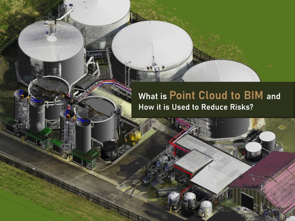
In today’s construction and architecture projects, accuracy matters. Even small measurement mistakes can cause design conflicts, budget overruns, and delays. Point cloud BIM solves this by using real site data to create accurate digital models. When combined with Scan to BIM Services, BIM modeling from point cloud data gives project teams a clear and reliable view of existing site conditions before design or construction begins.
This article explains what Point Cloud to BIM is, how the process works, the software and cost involved, and how it helps reduce risk in AEC projects.
What Is Point Cloud to BIM?
Point Cloud to BIM is the process of converting data captured by 3D laser scanners or LiDAR devices into a detailed Building Information Model. A point cloud is made up of millions of small data points that record the exact shape and size of buildings, structures, and spaces using X, Y, and Z coordinates. This point cloud to BIM conversion is how raw scan data becomes a usable model.
The point cloud data is imported into BIM software like Autodesk Revit and turned into an intelligent 3D model. The result is an accurate point cloud to a BIM model that represents the real site conditions and can be used for design, renovation, construction planning, and facility management. Because the process works for any structure, taking point clouds to BIM is now a standard first step on most renovation and retrofit projects.
How Is Point Cloud Data Captured?
The process begins with 3D laser scanning or LiDAR surveying. These advanced scanning tools capture high-accuracy spatial data by emitting laser beams that bounce back from surfaces. Each reflection is recorded as a data point, and millions of these points create a comprehensive 3D cloud.
Site Laser Scanning
Point Cloud Registration
Data Cleaning and Processing
Convert Point Cloud to BIM
Why Is Point Cloud to BIM Important for the AEC Industry?
Many construction projects run into trouble because of outdated drawings, missing information, or incorrect site measurements. Traditional surveying often fails to capture complex details. Point cloud BIM provides a clear digital record of existing conditions and removes the guesswork, which is exactly why it has become a core part of modern BIM Services. With an accurate model of what is really on site, every team starts from the same trusted source of truth.
Benefits for Different Teams
- Architects can design accurately using real site conditions.
- Engineers can study structural and MEP systems without repeated site visits.
- Contractors can identify issues early and avoid on-site changes.
- Owners and Facility Managers get accurate digital records for future use.
How Point Cloud to BIM Helps Reduce Project Risks
1. Reduces Measurement Errors
Laser scanning captures very accurate data and removes the risk of human measurement mistakes.
2. Detects Design Clashes Early
BIM models created from point clouds help identify clashes between structural, mechanical, and electrical systems before construction starts.
3. Improves Planning and Cost Control
Accurate models help teams plan better, estimate quantities correctly, and reduce unexpected change orders.
4. Supports Safer Renovation Projects
Digital site data reduces the need for repeated physical site visits, which improves safety and saves time.
5. Creates Reliable As-Built Models
Point cloud to BIM conversion provides accurate as-built BIM models that can be used for future renovations and facility management.
Software and Tools Used for Point Cloud to BIM
Choosing the right point cloud for BIM software matters because the workflow spans three tool types: scanning hardware, point cloud processing software, and BIM modeling software. Here are the tools used at each stage.
3D Scanning Tools
Leica, Faro, Trimble, NavVis, Matterport
Point Cloud Processing Software
BIM Modeling Software
Autodesk Revit, Navisworks, ArchiCAD, Vectorworks
The Point Cloud to BIM Process: Step by Step
- Site scanning: A 3D laser scanner or LiDAR device captures the existing structure as millions of measured points.
- Registration and cleanup: The individual scans are aligned into one unified point cloud, and noise or stray points are removed.
- Import into BIM software: The cleaned point cloud is brought into a tool like Autodesk Revit as the reference for modeling.
- Modeling: Modelers trace the point cloud into intelligent BIM elements, such as walls, columns, doors, windows, and MEP components, at the agreed level of detail.
- Quality check: The finished model is compared back against the point cloud to confirm it matches the real conditions within tolerance.
Conclusion
Point Cloud to BIM is an innovative and reliable way to capture real building conditions and convert them into accurate BIM models. It helps reduce errors, avoid rework, improve safety, and control project costs.
At BIMPRO LLC, a leading BIM company in the USA, we provide high-quality Point Cloud to BIM services for renovation, retrofit, and construction projects. Our experienced team delivers accurate and detailed BIM models that support confident decision-making throughout the project lifecycle.
Ready to Start Your Point Cloud to BIM Project?
Contact BIMPRO LLC today to discuss your project requirements and get accurate BIM models you can trust.
Request a free consultation or ask for a sample model.
You can reach out to us at +1 (346) 508-6588 or via email at info@bimprous.com.
Frequently Asked Questions
What is the cost of a 3D point cloud to a BIM service?
The 3D point cloud to BIM service cost depends on the size and complexity of the building, the level of detail required, and the scopes involved (architectural, structural, MEP). A small single-room model costs far less than a full multi-storey building. The best way to get an accurate figure is to share the scan area and your target level of detail, and we will quote it. The cost is usually offset by fewer errors, less rework, and faster decisions.
What software is used for point cloud to BIM?
Point cloud to BIM software spans three stages: scanning hardware (Leica, Faro, Trimble, NavVis, Matterport), point cloud processing (Autodesk ReCap, Leica Cyclone, Faro SCENE), and BIM modeling (Autodesk Revit, Navisworks, ArchiCAD). Most projects model the registered point cloud in Revit.
What is the architectural point cloud to BIM process?
The architectural point cloud to BIM process is: scan the building, register and clean the scans into one point cloud, import it into BIM software, model the elements (walls, doors, windows, finishes) to the agreed level of detail, then quality-check the model against the point cloud. The result is an accurate as-built model of the existing architecture.
Do you offer point cloud to BIM conversion in the US?
Yes. We provide point cloud to BIM conversion in the US for renovation, retrofit, and construction projects nationwide. As an established BIM Consulting Firm, we can also advise on scanning, the level of detail, and the right workflow for your project.
How accurate is a point cloud to a BIM model?
A point cloud to a BIM model is highly accurate because it is built directly from measured laser scan data rather than old drawings. Accuracy is set by the scan quality and the agreed level of detail, and a final quality check confirms the model matches the real conditions within tolerance.
